Tag Archives: nimbus

[February 20, 1970] Fun-nee enough… (OSCAR 5 and the March 1970 Fantasy and Science Fiction)

[New to the Journey?  Read this for a brief introduction!]

A black-and-white photo portrait of Kaye Dee. She is a white woman with long, straight dark hair worn down, looking at the camera with a smile.

by Kaye Dee

Recently, The Traveller covered the launch of the TIROS-M weather satellite, noting that the rocket’s payload also included a small Australian-made ham radio satellite, OSCAR-5 (Orbiting Satellite Carrying Amateur Radio), also known as OSCAR-A.

Photograph of the cover of Goddard News depicting a rocket staged for launch
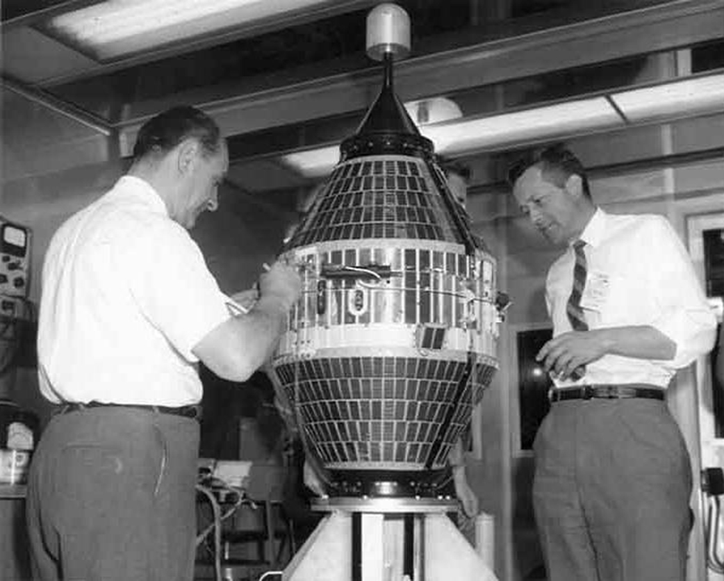
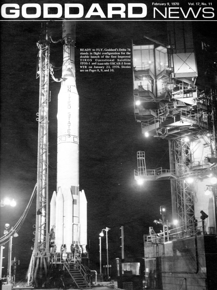
Cover of NASA's Goddard Space Flight Centre's in-house magazine, marking the launch of ITOS-1/TIROS-M and Australis-OSCAR-5

A New Star in the Southern Cross

It was exciting to be in “Mission Control” at the University of Melbourne when the satellite was launched in the evening (Australian time) on 23 January. You should have heard the cheers! After all, Australis-OSCAR-5 (AO-5), as we call it, is Australia’s second satellite. It’s also the first amateur radio satellite built outside the United States and the first OSCAR satellite constructed by university students – in this case, members of the Melbourne University Astronautical Society (MUAS).

Photograph of seven suited white men with exuberant expressions standing in an alley presenting the model satellite
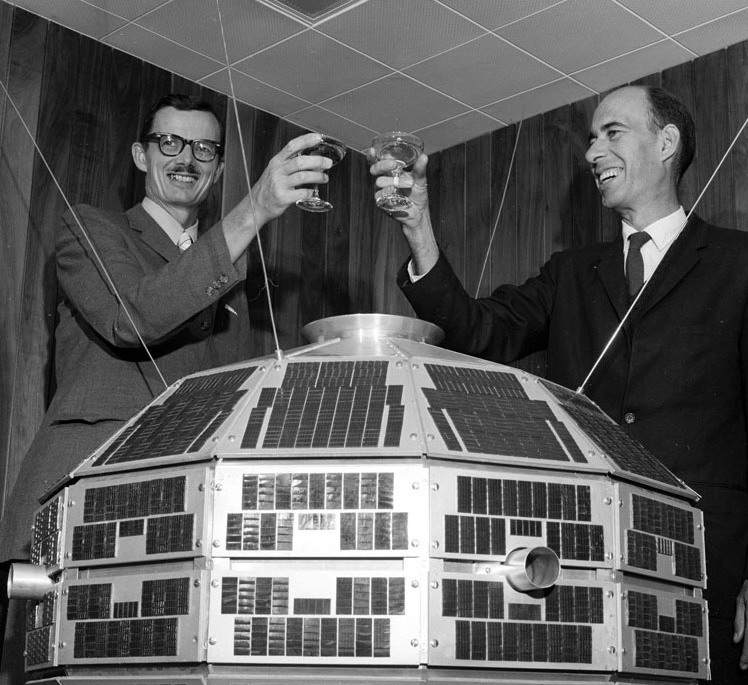
The MUAS student team with the engineering model of Australia's first amateur radio satellite

Radio Hams and Satellite Trackers

Commencing in 1961, the first OSCAR satellite was constructed by a group of American amateur radio enthusiasts. Cross-over membership between MUAS and the Melbourne University Radio Club (MURC) encouraged the students to begin tracking OSCAR satellites, moving quickly on to tracking and receiving signals from many other US and Soviet satellites.

Satellite photograph of cloud fronts moving over the continentNimbus satellite image of the western half of Australia received by MUAS for the weather bureau

One of MUAS’ achievements was the first regular reception in Australia of images from TIROS and Nimbus meteorological satellites. By 1964, they were supplying satellite weather images daily to the Bureau of Meteorology, before it established its own receiving facilities.

"How Do We Build a Satellite?"

After tracking OSCARs 3 and 4 in 1965, the MUAS students decided to try building their own satellite. “No one told us it couldn’t be done, and we were too naive to realise how complex it would be to get the satellite launched!”, an AO-5 team member told me at the launch party. MUAS decided to build a small ‘beacon’ satellite which would transmit telemetry data back to Earth on fixed frequencies.

Even before Australia’s first-launched satellite, WRESAT-1, was on the drawing board, the Australis satellite project commenced in March 1966. Volunteers from MUAS, MURC and university staff worked together to design and build the satellite, with technical and financial assistance from the Wireless Institute of Australia and a tiny budget of $600. The Australian NASA representative also gave the project invaluable support. The students acquired electronic and other components through donations from suppliers where possible: the springs used to push the satellite away from the launcher were generously made by a mattress manufacturer in Melbourne. Any other expenses came out of their own pockets!

Picture of AO-5 in launch configuration, somewhat resembling a metal-wrapped gift bound up twine holding the furled antennae down as 'the ribbon'
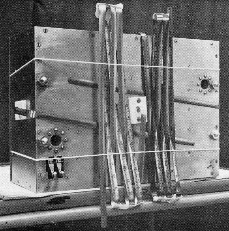
Carpenter's steel tape was used to make AO-5's flexible antennae, seen here folded in launch configuration. Notice the inch markings on the tape!

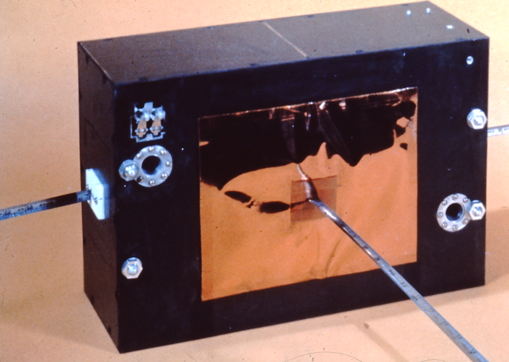
AO-5 is a fantastic example of Aussie ‘make-do’ ingenuity. A flexible steel measuring tape from a hardware shop was cut up to make the antennae. The oven at the share house of one team member served to test the satellite’s heat tolerance, and a freezer in the university's glaciology lab was unofficially used for the cold soak. Copper circuit boards were etched with a technique using nail varnish, and a rifle-sight was used to help tune the antennae! Various components, including the transmitters and command system, were flight-tested on the university’s high altitude research balloon flights.

Colour photograph of the bare circuit-boards set up in a freezer
Colour photograph of a payload collection staged at the back of a truck in preparation for balloon flight
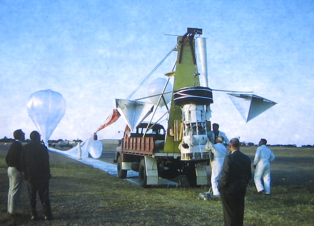
A university lab freezer and hitching a ride with university experiments on US HiBal high altitude balloon flights in Australia used to test the ruggedness of AO-5 components

A Long Wait for Launch

Australis was completed and delivered to Project OSCAR headquarters in June 1967, well before WRESAT’s launch in November that year. Unfortunately, AO-5 then had to wait a few years for a launch to be arranged by the Amateur Radio Satellite Corporation (AMSAT), which now operates the OSCAR project. However, it is surely appropriate that, as OSCAR-5, it finally made it into orbit with a weather satellite.

Colour photographs of the launch vehicle staged at Vandenberg Air Force Base, both before and during ignition

After launch from Vandenberg Air Force Base, AO-5 was placed into a 115-minute orbit, varying in altitude between 880 – 910 miles. This means it will be in orbit for hundreds of years – unlike the short-lived WRESAT.

In Orbit at Last!

Battery-powered, Australis-OSCAR-5 weighs only 39 pounds and carries two transmitters, beaming out the same telemetry signal on the two-metre and 10-metre amateur radio bands. Its telemetry system is sophisticated but designed for simple decoding without expensive equipment. The start of a telemetry sequence is indicated by the letters HI in Morse code, followed by data on battery voltage, current, and the temperature of the satellite at two points as well as information on the satellite's orientation in space from three horizon sensors.

Colour photograph of the Australis OSCAR 5 (a rectangular box) with metal antennae extended

AO-5 includes the first use in an amateur satellite of innovations such as a passive magnetic attitude stabilisation system (which helps reduce signal fading), and a command system to switch it on and off to conserve power. Observations are recorded on special standardised reporting forms that are suitable for computer analysis.

Photograph of a telemetry coding form noting that the satellite is spinning at four rotations per minute

Just 66 minutes after launch, the first signal was detected in Madagascar and soon other hams reported receiving both the two and 10-metre signals on the satellite's first orbit. At “Mission Control” in Melbourne, we were thrilled when MURC members managed to pick up the satellite’s signals!  By the end of Australis’ first day of operation, AMSAT headquarters had already received more than 100 tracking, telemetry and reception reports.

Photograph of news clippings from The Australian (and other publications).  They provide a photograph of the satellite in pre-launch attitude (with furled metal antennae) and photographs (including a portrait of Richard Tonkin) of members of the Melbourne team who designed and built it.A selection of local newspaper cuttings following AO-5's launch. There was plenty of interest here in Australia.

The two-metre signal failed on 14 February, but the 10-metre transmission continues for now. How much longer AO-5’s batteries will last is anybody’s guess, but the satellite has proven itself to be a successful demonstration of the MUAS students’ technical capabilities, and the team is already contemplating a more advanced follow-on satellite project.

Picture of a post-card (posted Jan 23 1970, with an Apollo 8 stamp) with an illustration of a satellite over what appears to be a map of weather fronts. Above the illustration it reads 'ITOS-1 Day-Night Weather Eye', and to the side it reads 'Oscar 5' and 'Australis'
This philatelic cover for the ITOS-1/TIROS-M launch, includes mention of AO-5, but the satellite depicted is actually OSCAR-1


photo of a man with glasses and curly, long, brown hair, and a beard and mustache
by Gideon Marcus

Fantastic emanations on Earth

And now that you've had a chance to digest the latest space news, here's some less exciting (but no less necessary) coverage of the latest issue of F&SF.

Cover of The Magazine of Fantasy and Science Fiction's March issue-- the cover illustration is a square wrapped wrapped in digits with the top sequence running from 1-17, and the others presenting variations on the sequence.  The inside of the square appears to show four mirrored illustrations of men laying under blankets as though awaiting surgery.  Extending from the crowns of their heads to the center of the square are matching banded gradients from pale to dark blue.
by Ronald Walotsky

Continue reading [February 20, 1970] Fun-nee enough… (OSCAR 5 and the March 1970 Fantasy and Science Fiction)

[September 6, 1964] New Stars in the Sky (Explorer 20, Nimbus, and OGO-1)

[We have exciting news!  Journey Press, the publishing company founded by the team behind Galactic Journey, has just launched its first book.  We know you will enjoy Rediscovery: Science Fiction by Women (1958-1963), a curated set of fourteen excellent stories introduced by the rising stars of 2019. 

If you enjoy Galactic Journey, you'll want to purchase a copy today — available physically and virtually!]


by Kaye Dee

I love watching satellites — and it seems like every week now there are new stars in the sky as more satellites are launched to help us learn more about outer space and the Earth itself. Just in the past two weeks, we’ve seen three new satellites dedicated to discovering more about the Earth’s atmosphere and the way it works.

Explorer-XX: Topside Down

The first of the recent launches was Explorer-XX, finally orbited on 25 August from Vandenberg Air Force Base in California after problems with its Scout X-4 booster that took many months to resolve. Explorer-XX has a string of aliases: it’s also known as Ionosphere Explorer IE-A, Ionosphere 2, Science S-48, Topside-sounder, TOPSI and Beacon Explorer BE-A! Underneath all those monikers, it’s the latest in the series of scientific research satellites that began with America’s first satellite, Explorer-I, back in 1958.


Explorer-XX under construction

Explorer-XX’s main purpose is to act as a topside sounder, which means that it takes measurements of the ion concentration within the ionosphere from orbit above it. This data can then be compared with measurements taken from the ground. Since the ionosphere is what makes global radio communications possible, understanding its composition and characteristics is important to scientific and defence research, as well as international radio telecommunications operators.

Unlike some satellites, Explorer-XX doesn’t have an onboard tape recorder, so it can only transmit data when it’s in range of a ground station. One of those ground stations happens to be just outside the Woomera Rocket Range, at NASA’s Deep Space Instrumentation Facility at Island Lagoon. Island Lagoon is actually a dry salt-lake (and not a bad picnic spot for a nice Sunday outing from Woomera Village), and its shores proved to be an ideal location for NASA’s first deep space tracking station outside America. Last year, the Minitrack radio-interferometry tracking system that was originally installed on Woomera’s Range G to support satellite tracking during the International Geophysical Year, was moved to the Island Lagoon site. Minitrack is part of NASA’s Satellite Tracking and Data Acquisition Network and it can receive the Explorer-XX data. Some of the sounding rocket work out at Woomera also involves taking ionospheric soundings for defence and civilian scientific research, so I’m sure my colleagues at WRE will soon be incorporating the data from Explorer-XX into their research as well.


NASA's Minitrack station at Island Lagoon, near Woomera – one of the data receiving stations for Explorer-XX

Following in Canada's Footsteps

Explorer-XX is only the second topside sounder ever launched. The first was Alouette-1, Canada’s first satellite, which went into orbit almost exactly two years ago and is still in operation. Alouette-1, by the way, was part of a program in which the United States generously offered to launch satellites for other countries. Great Britain and Canada have already had their first satellites launched this way, and Italy will soon have a satellite launched by NASA as well. Australia had an invitation to take part in this project, too, but while I was working for the WRE, I heard that our government had rejected the offer on the basis that the country couldn’t afford it — which is pretty short-sighted thinking, if you ask me!

Canadian scientists celebrating the launch of their first satellite-Alouette-1. Wish there was a picture of Australian scientists doing the same.

Nimbus-1: Second-Generation Weather Satellite

Even if the Australian Government lacked the vision to take up America’s offer of a satellite launch, it is interested in taking advantage of the practical ways in which satellite can benefit the country. Last month, I mentioned Australia’s intention to be part of the INTELSAT communications satellite consortium, and our Bureau of Meteorology is fast becoming a major user of weather satellites. Its ground station was one of 47 outside the United States to receive live weather images broadcast directly from space from the TIROS-8 weather satellite launched last December. Some test transmissions were received from TIROS-8 on Christmas Day, just a few days after its launch, and images have been regularly received since January 7 this year.

Now, the first of a new weather type of weather satellite is in orbit, from which Australia is also receiving data. Nimbus-1 (aka Nimbus-A) was launched from Vandenberg just a few days after Explorer-XX, on August 28. It’s now in polar orbit, more eccentric than desired because of a short second-stage burn, but all its instruments are functioning and ground stations are receiving regular data.


Some people think Nimbus-1 looks like a butterfly, though it reminds me of an ocean buoy with solar panels attached either side!

Like TIROS-8, Nimbus-1 can transmit live cloud images from orbit using the Automatic Picture Transmission instrument. This television system is designed to photograph an area of 800 miles square, which is the largest field of view to date. The pictures are transmitted using a slow-scan system of four lines per second, similar to the way radio photographs are sent. Each ground station is designed to receive three pictures per orbit. Nimbus can also store data on board and retransmit it later if it is not in range of a ground station. But what makes Nimbus-1 different from TIROS-8 is that its High-Resolution Infra-red Radiometer enables it to take images at night and measure the night-time radiative temperature of cloud tops and the Earth’s surface, so that data is being acquired all day, every day.


Here's a diagram of Nimbus-1 showing its main components and instruments.

On its first day in orbit, Nimbus took a picture of Hurricane Cleo as it travelled north along the US east coast after devastating parts of the Caribbean and Florida. This really demonstrates that with the data and images from the TIROS and Nimbus satellites, the Bureau of Meteorology will now be able to reliably track the development of conditions over the Pacific, Southern and Indian Oceans that determine the weather across different parts of Australia. The poet Dorothea Mackellar didn’t call Australia the “land of droughts and flooding rains” for nothing, but weather satellites will undoubtedly improve the forecasters’ abilities to see when these weather conditions are coming!


Hurricane Cleo imaged by Nimbus-1. Its strike on Florida delayed the launch of the Gemini-2 unmanned test flight.

Orbiting Geophysical Observatory-1: A New Design Paradigm

Just two days ago, 5 September (Australia time), NASA’s third recent satellite was launched. This time it was the Orbiting Geophysical Observatory, or OGO-1, the first of a series of satellites that is intended to study the atmosphere, magnetosphere and the space environment between the Earth and the Moon, making sure that it will be safe for the Apollo astronauts to traverse this region of space.


This philatelic cover marking the launch of OGO-1 highlights its role in manned spaceflight safety.

OGO-1 is the largest and most complex scientific satellite that NASA has launched to date. With the OGO series, NASA is taking a new approach to satellite design. Until now, each satellite has been designed to accommodate the instruments and experiments that it would carry. However, with OGO, the satellite design is fixed and the experiments are tailored to fit the satellite. Each satellite will carry about 20 experiments.


Diagram of the universal OGO bus that will be used for all the satellites in the series.

OGO-1 has been placed into a highly elliptical orbit with an apogee of almost 93,000 miles, and the plan is for future OGO missions to alternate between this type of orbit and low polar obits. At 31° inclination (its angle with respect to the equator), the OGO series needs additional tracking stations to supplement NASA’s STADAN network. One of these support stations will be established next year in Darwin, in the Northern Territory, as an outstation of the STADAN station at Carnarvon. This facility is part of the NASA Carnarvon tracking station that I mentioned in my last article, which is a prime tracking station for the upcoming Gemini missions.

Unfortunately, one of OGO-1's long booms and one of its short booms did not properly deploy. As a result the satellite used up most of its stablisation-thruster fuel attempting to lock the satellite into its Earth-stabilised orbit. For the moment, scientists have decided not to turn on any of OGO-1's instruments while they work out ways to operate it as a spin-stablised satellite. Let's hope they succeed as this satellite and its successors promise a wealth of new data on the near-space environment.


OGO-1's deployment from its folded launch configuration to its operational configuration is rather complex. I guess it's not surprising that this new satellite has had some problems in properly unfolding!

It’s exciting to see so many new space missions occurring and knowing that, through the tracking stations around the country (managed by the WRE on NASA’s behalf and operated by local engineers and technicians) Australia is playing its part in the exploration and peaceful use of outer space. I can scarcely wait to see what goes up next month!