
by Kaye Dee
Just a few days ago, on July 15, NASA’s Mariner IV space probe made history by being the first spacecraft to successfully reach the planet Mars, capturing images of its surface. These are the first close-up views of another planet in our solar system and the initial pictures suggest that, despite what science fiction would have us believe, Earth won’t have to fear an invasion from Mars any time soon!
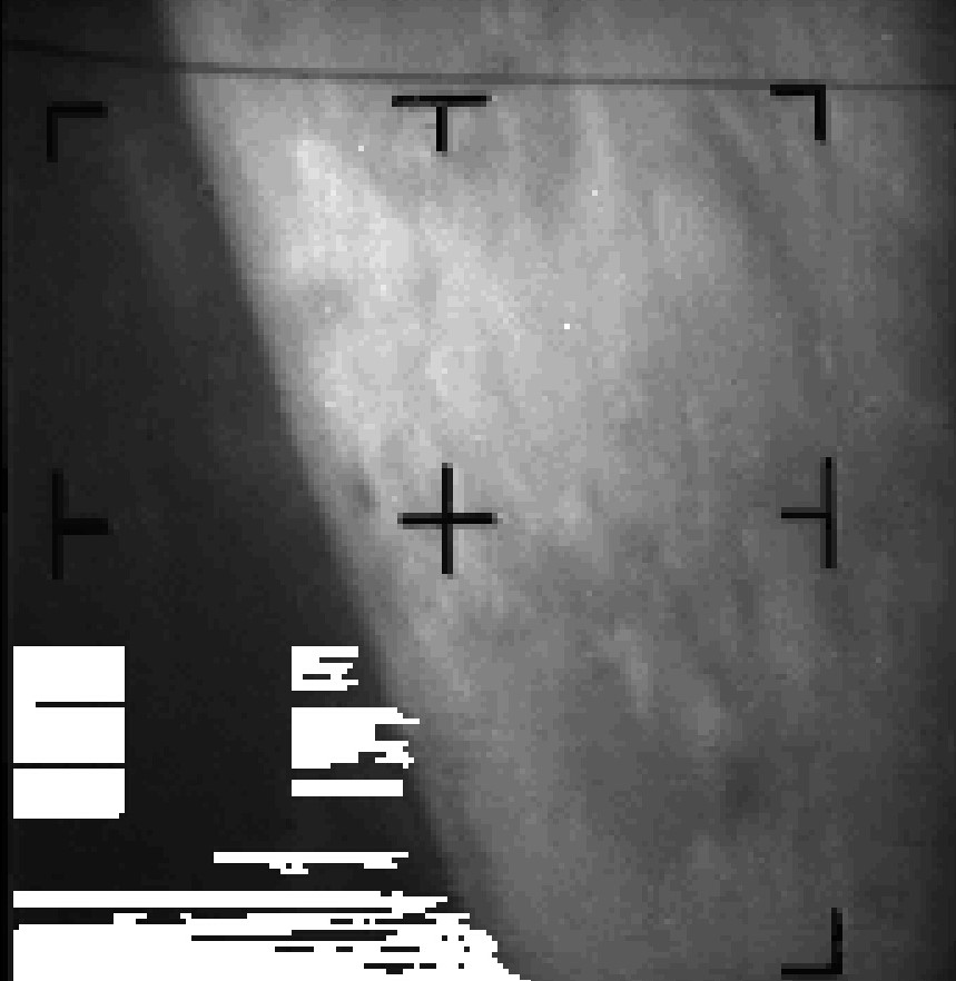
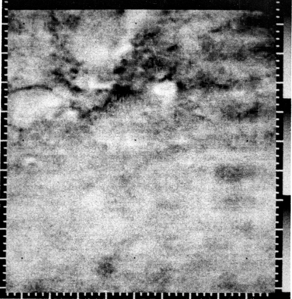
The first close-up image ever taken of Mars, showing the limb of the planet and a haze-like feature that might be clouds. The smallest features in this image are roughly 3 miles across, but there's no sign of Martian canals!
The Canals of Mars
Mars has been an object of intense scientific and popular fascination since the last century, when telescope observations first suggested that the planet was potentially Earthlike, since it showed polar caps and surface changes that appeared to represent seasonal variations due to the growth and die-back of vegetation. Then, in 1877, the Italian astronomer Schiaparelli observed what he called “canali” on Mars. He apparently meant grooves or channels on the Martian surface, but his work was translated into English as “canals” and some astronomers took this literally to mean that he had observed structures that were the work of intelligent beings.

A section of one of Percival Lowell’s maps of Mars, published in his 1895 book Mars. The complete map depicted 184 named canals marked on it using numbers.
By the end of the 19th Century, the idea that there is intelligent life on Mars had taken hold, thanks particularly to the writings of American astronomer Percival Lowell (the same Percival Lowell who is also associated with the discovery of the Planet Pluto!) He believed in a Martian civilisation that had constructed vast networks of canals to bring water from the planet’s poles and wrote several books and innumerable newspaper articles detailing his observations of canal systems on the Red Planet. Science fiction stories like H.G. Well’s War of the Worlds, first published in 1897, and Edgar Rice Burroughs' "Barsoom" series further encouraged popular belief that there was intelligent life on Mars and generated something of a ‘Mars mania’ that has grown across the 20th Century.

Cover of the August 1927 issue of Amazing depicting the iconic Martian machines from Wells' War of the Worlds. This powerful story has been re-interpreted on radio and film and has had a tremendous influence in shaping popular perceptions of life on Mars.
The Mars Race
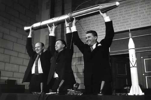
Most scientists have accepted for a decade or more now that modern telescope observations indicate that it is unlikely that higher forms of life will be found on Mars after all. Yet the fascination with Mars has been so strong that it’s not surprising the planet became an early target for space exploration, after the Moon. The Soviet Union started the race to Mars in October 1960, with “Marsnik” 1 and 2. We don’t know much about these probes, but it seems they both failed even to reach orbit. The USSR’s Mars 1 flew past Mars in June 1963, but it had stopped sending back data in March. Sputnik 22 and Sputnik 24, both launched around the same time as Mars 1, are also believed to be elements of a failed Mars mission. Zond 2, launched just 2 days after Mariner IV, is also assumed to be an attempted Mars mission, though it, too, ceased transmitting en route. Clearly, getting to Mars is hard. Mariner IV was meant to be a twin mission with Mariner III, but that mission also failed at launch.
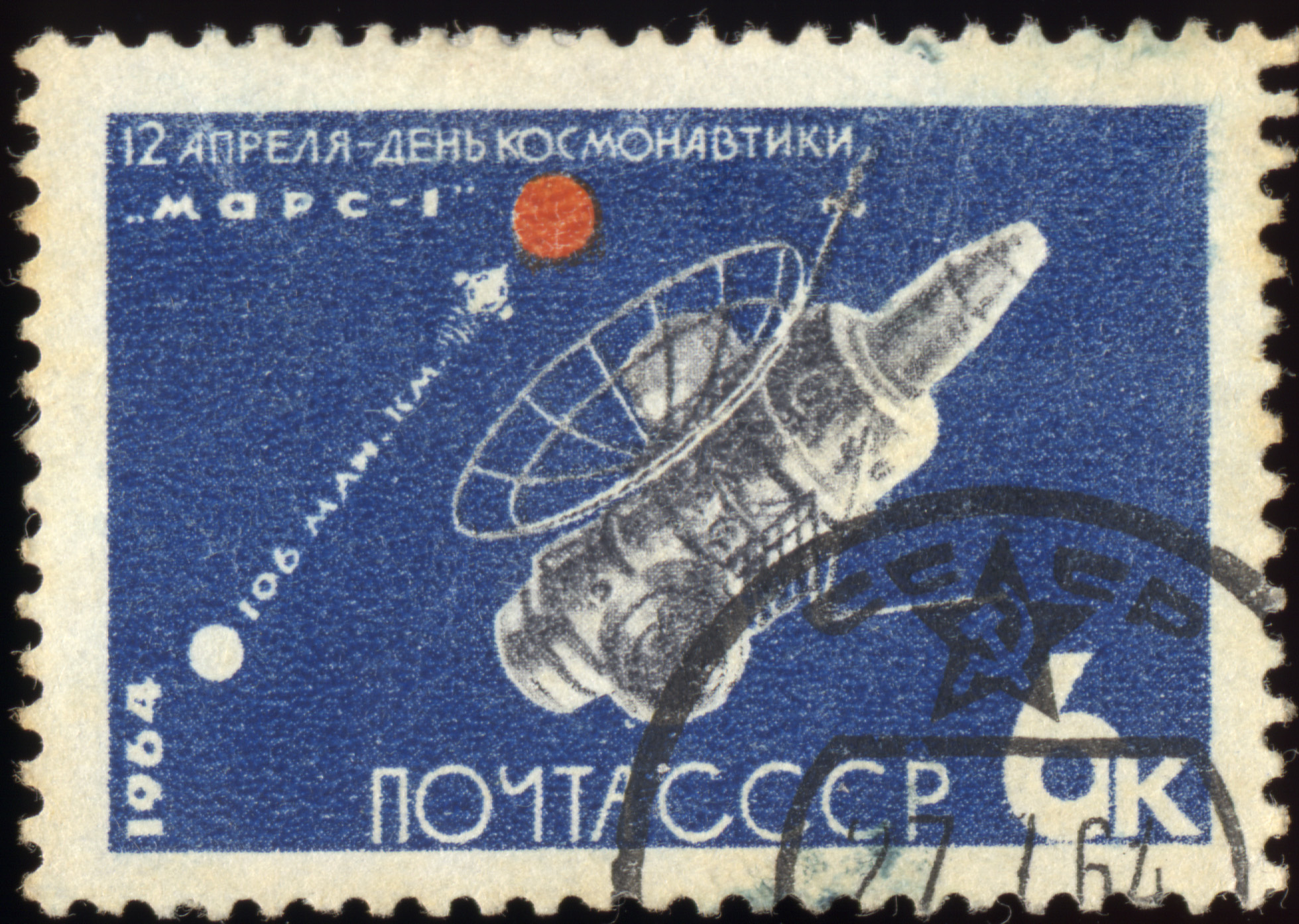
Even though Mars 1 ceased transmitting long before it reached Mars, the USSR still celebrated it as an achievement on its 1964 Cosmonauts Day stamp.
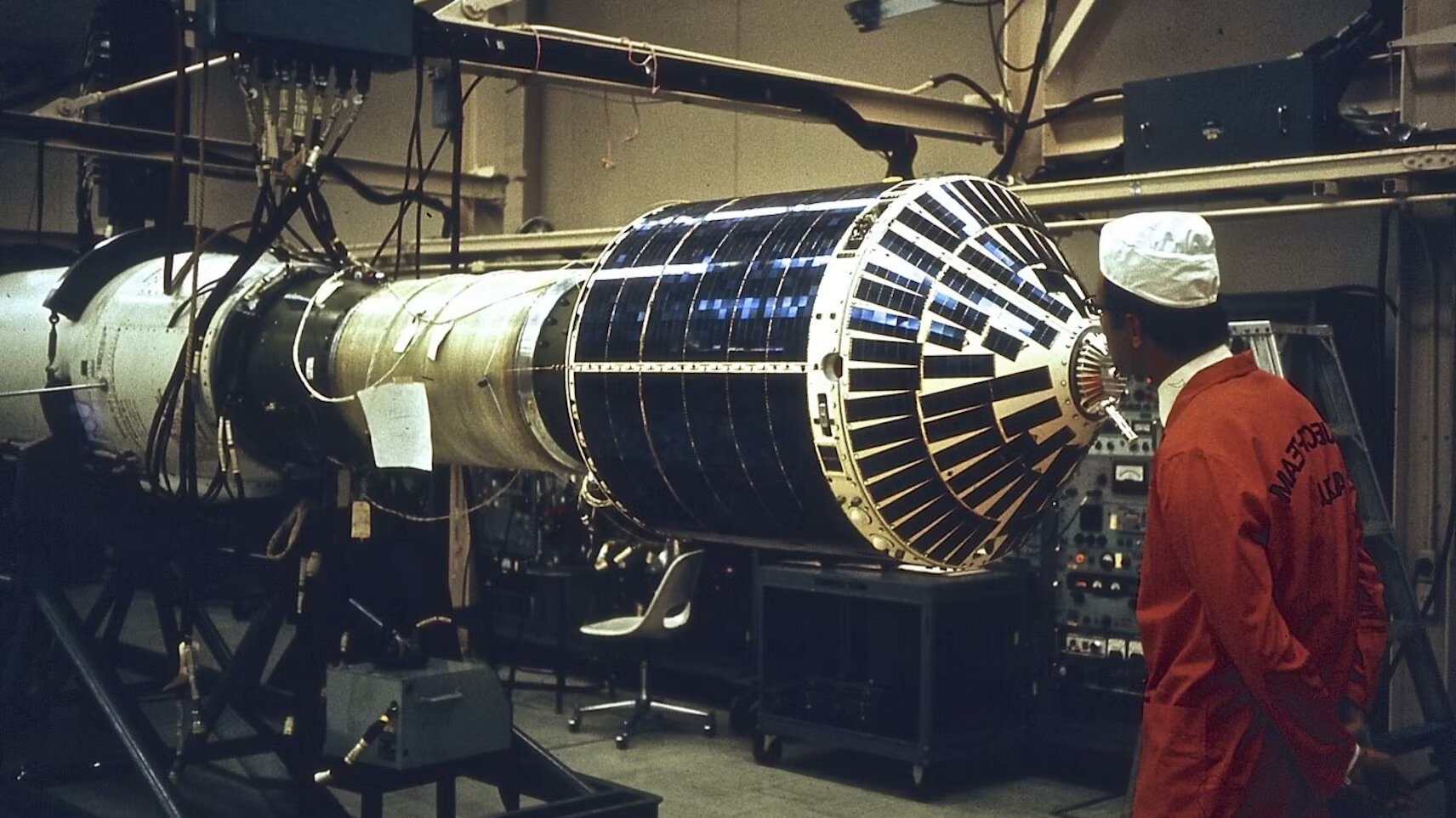
Mariner IV was launched on an Atlas Agena rocket from Cape Canaveral at 12:22 GMT on November 28, last year. It has an octagonal magnesium frame, 50 inches across the diagonal and 18 inches high, which houses the electronic equipment, propulsion system and attitude control gas supplies and regulators. Four solar panels, containing a total of 28,224 solar cells, are attached to the top of the frame. They are able to generate 310 watts of power at the distance of Mars from the Sun. Mariner also has two antennae for transmitting data back to Earth: An elliptical high-gain parabolic antenna and an omnidirectional low-gain antenna, mounted on a seven-foot, four-inch-tall mast next to the high-gain antenna.
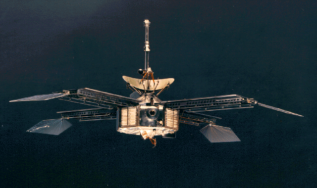
Mariner IV is an incredibly sophisticated space probe for its size, packed with scientific instruments, plus its television camera system. Its design is a radical departure from the conical design used for the Ranger Moon probes and NASA's successful Mariner II mission to Venus.
Deep Space Laboratory
For its relatively small size, Mariner IV is a spacegoing scientific laboratory, designed to measure the conditions in deep space between Mars and the Earth and in the vicinity of Mars itself. Its scientific instruments include a helium magnetometer to measure the characteristics of the interplanetary and planetary magnetic fields; an ionization chamber/Geiger counter, to measure the charged-particle intensity and distribution in interplanetary space and in the vicinity of Mars; a cosmic ray telescope, to measure the direction and energy spectrum of protons and alpha particles; a solar plasma probe, to measure the very low energy charged particle flux from the Sun, and a cosmic dust detector, to measure the momentum, distribution, density, and direction of cosmic dust. Although the Geiger counter failed in February and the plasma probe's performance is degraded, the other instruments are all working well.

Mariner IV's 'endless loop' magnetic tape recorder. Its 330ft of tape has a storage capacity of 5.24 million bits – right at the cutting-edge of recording technology!
Probably the most important instrument on Mariner IV, and certainly the one of the most interest to the public, is its television camera, designed to obtain close-up images of the Martian surface. The camera is mounted on a scan platform at the bottom centre of the spacecraft and consists of 4 parts: a Cassegrain telescope with a 1.05° by 1.05° field of view; a shutter and red/green filter assembly with 0.08s and 0.20s exposure times; a slow scan vidicon tube which translates the optical image into an electrical video signal, and the electronic systems required to convert the analogue signal into a digital signal for transmission. During the fly-by of Mars, all the television images and the data gathered by the scientific instruments were stored on an ‘endless loop’ four-track magnetic tape recorder for later transmission back to Earth.
First Pictures from Another World
On July 15 Mariner 4 passed within 6117 miles of Mars, spending just 25 minutes doing visual observations of the planet’s surface. During that brief time, its television camera captured 21 full pictures and part of a 22nd, the first ever close-up images of the surface of another planet. Each photo covers an area of about 77 square miles. It takes about 10 hours to transmit each image back to Earth and each picture is being transmitted twice to ensure that all the data is correctly received.
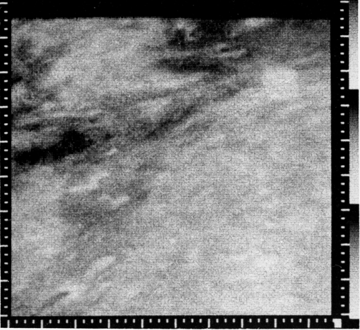
The second Mariner IV image released by NASA shows the border of Elysium Planitia and Amazonis Planitia. Taken from around 9,940 miles, the picture is about 310 miles across and 560 miles from top to bottom because the surface is curving away. North is up and the sun is illuminating the area from the southeast.
Only three of the Mariner Mars images have so far been released, but already they have disappointed scientists and the public alike by putting an end to any hope of finding intelligent life on the Red Planet. What they have so far revealed is a world that looks more like the Moon than the Earth, with no signs of water, vegetation or animal life. When this is coupled with the findings of the scientific instruments, which show that Mars has an atmosphere of carbon dioxide with only a very low atmospheric pressure (only a fraction of that found on Earth, which was quite a surprise to scientists), a daytime temperature of -148 degrees F and no magnetic field (meaning that the surface of the planet is bombarded by the solar wind and cosmic radiation), it means that the prospects for any kind of life on Mars are very small indeed. However, Mariner’s images only cover just 1% of the Martian surface, so perhaps we should not entirely give up hope that future missions will find Mars more exciting and scientifically interesting than it seems right now. After all, the pictures have not yet revealed the cause of the apparent seasonal changes observed from Earth….
The third image we have seen so far shows the Orcus Patera region in western Amazonis Planitia. It was taken with the sun only 13 degrees from vertical, so the topography is hard to make out, although some raised areas can be seen at upper left. The image is 202 miles across and 319 miles from top to bottom. The resolution is about 1.9 miles and north is up.
Australia Plays Its Part
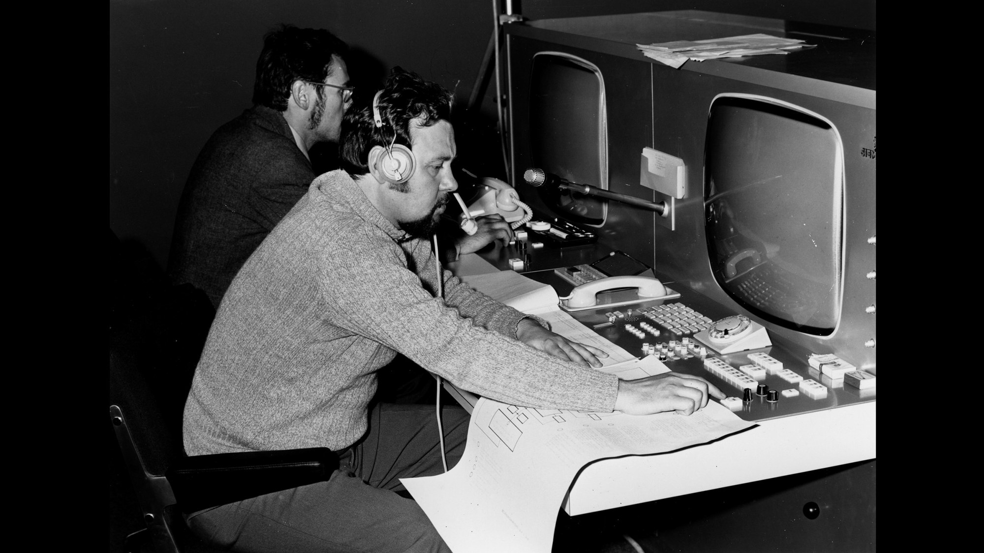
Australia has played a crucial role in the Mariner IV mission, with its first images being received at the Tidbinbilla tracking station outside Canberra. NASA’s second Deep Space Network station in Australia, Tidbinbilla became operational in December 1964 so that it could support the Mars mission. As the signal from Mars is very weak, the station asked the civil aviation authorities to divert any aircraft that might interfere with the reception of the signals from Mariner at the time of the fly-by. This resulted in an amusing incident: at the critical time, just when Mariner 4 had gone behind Mars, the direct phone from Canberra Airport rang and the station was asked if it was experiencing interference from a UFO! It now seems that the offending object was a weather balloon and not a Martian saucer come to check on what the Earthmen are up to.
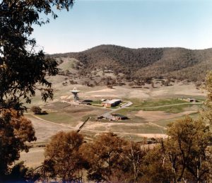
Nestled in a secluded valley, for protection from radio interference from nearby Canberra, NASA's Tidbinbilla Deep Space Network Station received the first images of Mars from Mariner IV. Australia is host to a growing number of NASA tracking stations covering all its space tracking networks.
A Role for a Radio Telescope
Australia’s Parkes radio telescope, the largest fully steerable radio telescope in the world, also played a role in receiving Mariner IV’s Mars images. NASA is basing the design of its new 210 ft antennae for the Deep Space Network on that of the Parkes telescope. As a demonstration of its tracking capabilities, Parkes has also tracked Mariner IV and received some of its images from Mars. Its greater antenna size, and therefore better reception capabilities, mean that its images will be more detailed than those received by the 85 ft dishes at Tidnbinbilla and other NASA stations and they will enhance the overall quality of Mariner IV’s Mars pictures when the Parkes and Tidbinbilla images are combined. I hope that NASA will release the rest of the Mariner images soon: even if they have dashed almost a century of Martian fantasies, they are revealing a planet that is very different from what we have expected and I wonder what further surprises might be in store for us as we explore more of Mars and the rest of the Solar System….
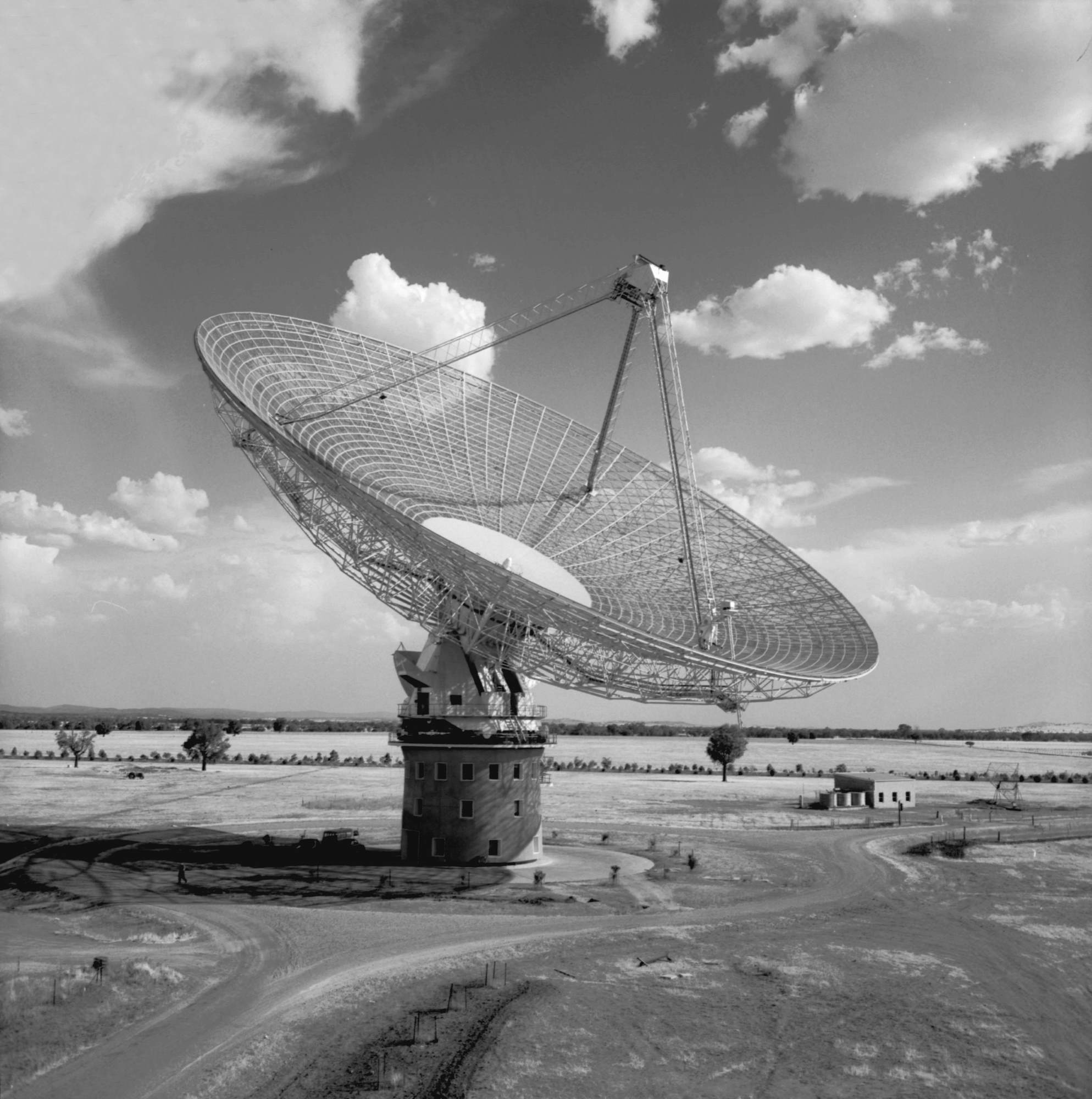
The world-leading radio telescope developed by the Commonwealth Scientific and Industrial Research Organisation, Australia's national civil scientific research body. Located near Parkes, New South Wales, this astronomical instrument is also proving its value as a space tracking facility and I'm sure that NASA will call on it again in the future for further tracking support


![[April 22, 1970] “Houston, We’ve had a Problem Here!” (Apollo-13 emergency in space)](https://galacticjourney.org/wp-content/uploads/2025/04/Apollo-13-13-672x372.jpg)

 Timeline of major mission events during Apollo-13
![[January 4, 1970] Word for the Day: ARPANET](https://galacticjourney.org/wp-content/uploads/2024/12/arpanetprocess-672x372.jpg)


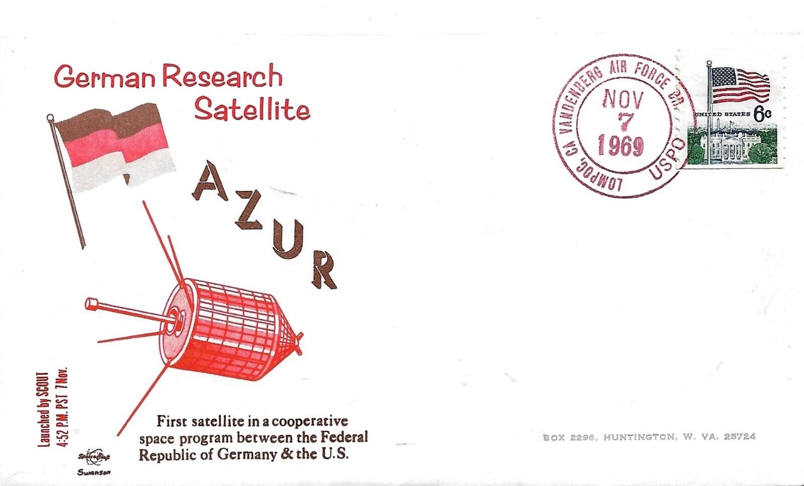
![[December 14, 1969] West Germany Joins the Space Race: The <i>Azur</i> Mission](https://galacticjourney.org/wp-content/uploads/2024/12/image-1000-a8400038c15870479f0a4413072bb6c32-672x372.jpeg)


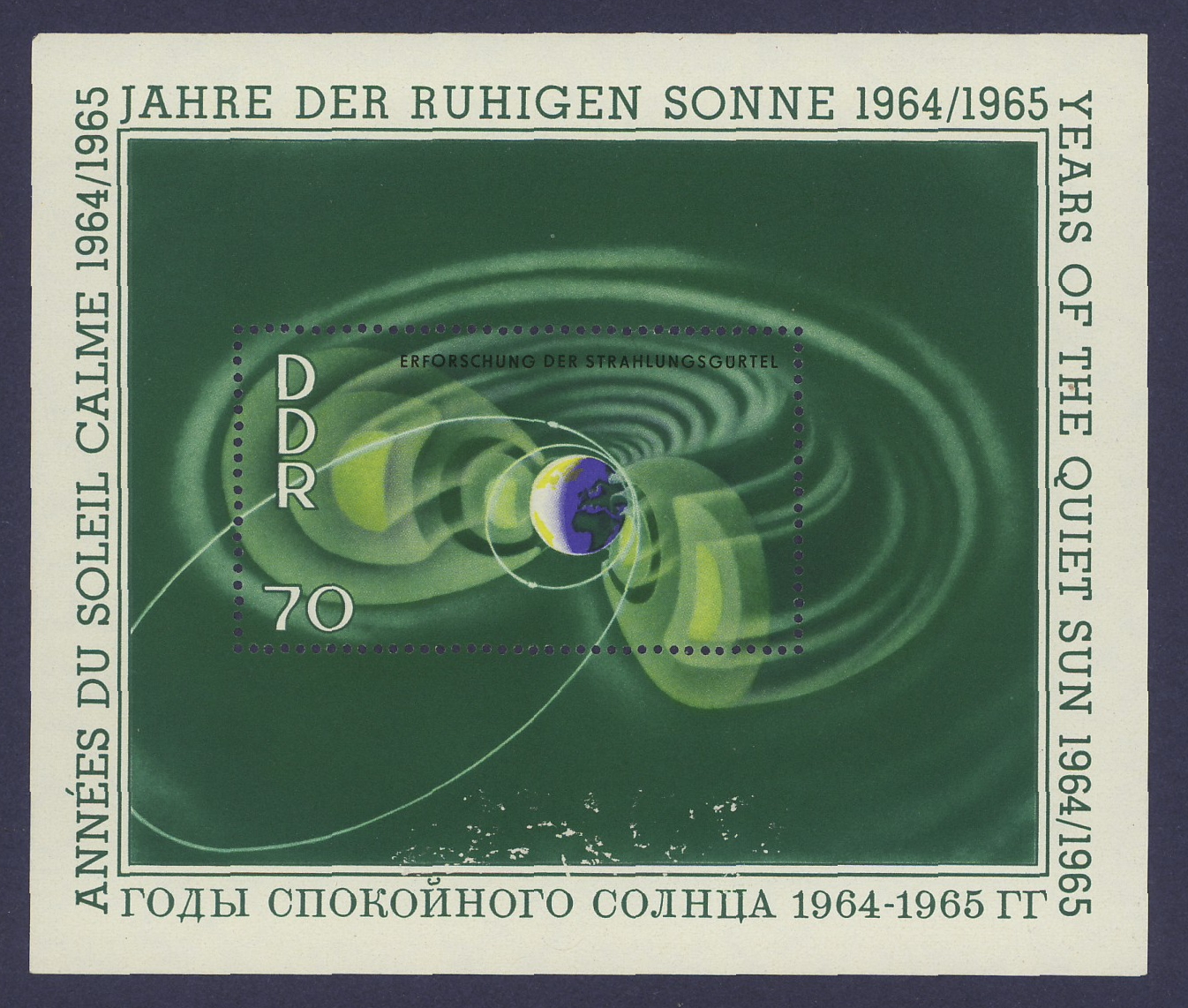
![[December 6, 1969] Here comes the Sun (and Moon) — Orbiting Solar Observatory, Apollo, ESRO, and Explorer 41!](https://galacticjourney.org/wp-content/uploads/2024/12/691206oso6a-637x372.jpg)


![[August 8, 1969] Two by Four (Mariners 6 and 7 go to Mars)](https://galacticjourney.org/wp-content/uploads/2024/08/690808approach6-672x372.jpg)

![[July 20, 1965] No War of the Worlds After All? (Mariner IV reaches Mars)](https://galacticjourney.org/wp-content/uploads/2020/07/mariner04-640x372.gif)

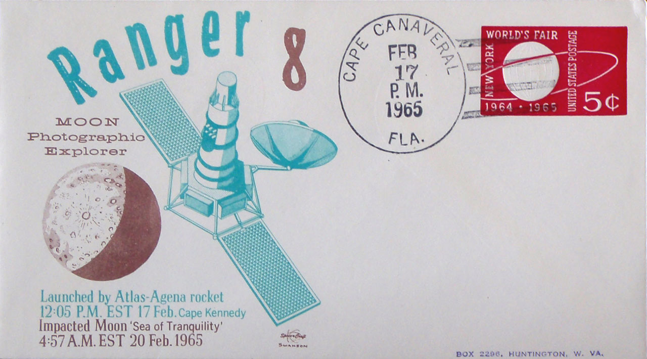
![[February 20, 1965] Twice as nice (Ranger 8)](https://galacticjourney.org/wp-content/uploads/2020/02/650220ranger8approach-576x372.jpg)


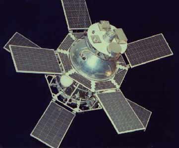
![[February 18, 1965] OSO Exciting! (February 1965 Space Roundup)](https://galacticjourney.org/wp-content/uploads/2020/02/650218oso2-576x372.jpg)


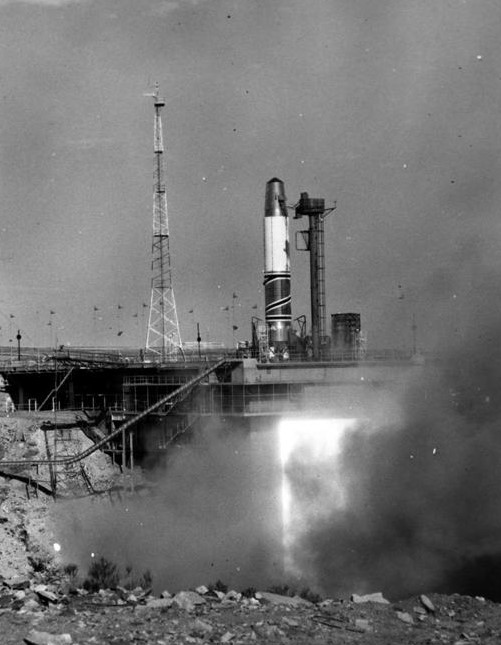
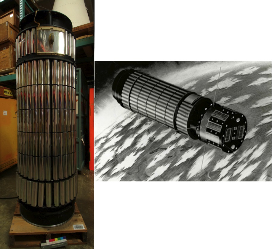
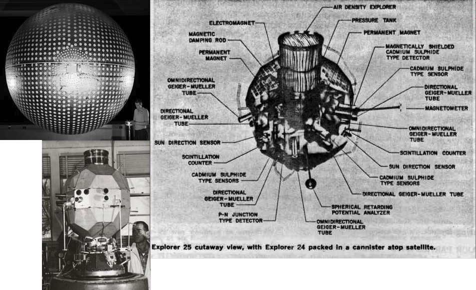
![[November 23, 1964] Let’s Go Exploring! (NASA’s latest Explorer satellites)](https://galacticjourney.org/wp-content/uploads/2019/11/641123montage-672x372.jpg)

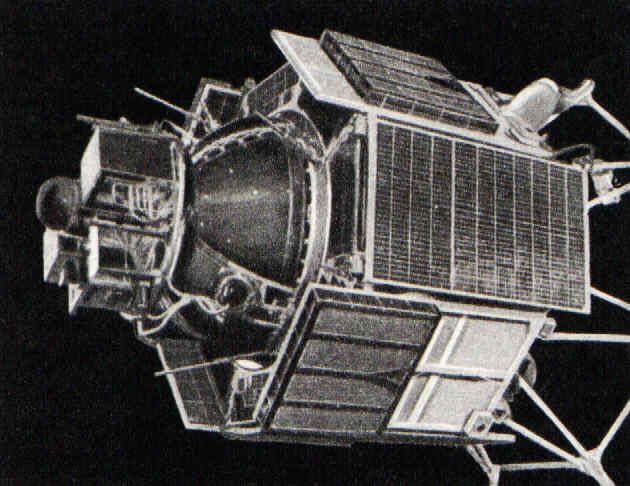
![[Oct. 16, 1964] Three in One (The next leg of the Space Race)](https://galacticjourney.org/wp-content/uploads/2019/10/641016voskhod1b.jpg)


